Se sei un viaggiatore che vuole davvero esplorare e vivere l’ambiente, allora il Turismo responsabile della Riserva fa per te: un nuovo, più etico e coinvolgente modo di intendere la visita del territorio che regala esperienze uniche ed emozionanti, in totale armonia con la natura.
Riserva Zompo lo Schioppo
Gli itinerari

 Da Rendinara (899 slm)
A Rifugio Lo Schioppo (730 m)
Dislivello massimo 280 m
Lunghezza 6,3 km
Ore 3 ore; E
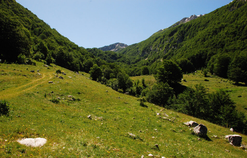
Questo percorso collega l’area sosta dello Schioppo con il polo Ecomuseale sulla pastorizia di Rendinara. Il percorso, di interesse storico-antropologico, permette di leggere i segni lasciati dalla pratica della pastorizia, che a Rendinara è ancora molto viva.
Clicca qui per scaricare la traccia gpx del percorso
Da Area sosta di Piano Sacramento per l’abitato di Brecciose (594 m)
A Morino Vecchio (577 slm)
Dislivello massimo 200 m.
Lunghezza 4,7 km
Ore 1,5; T
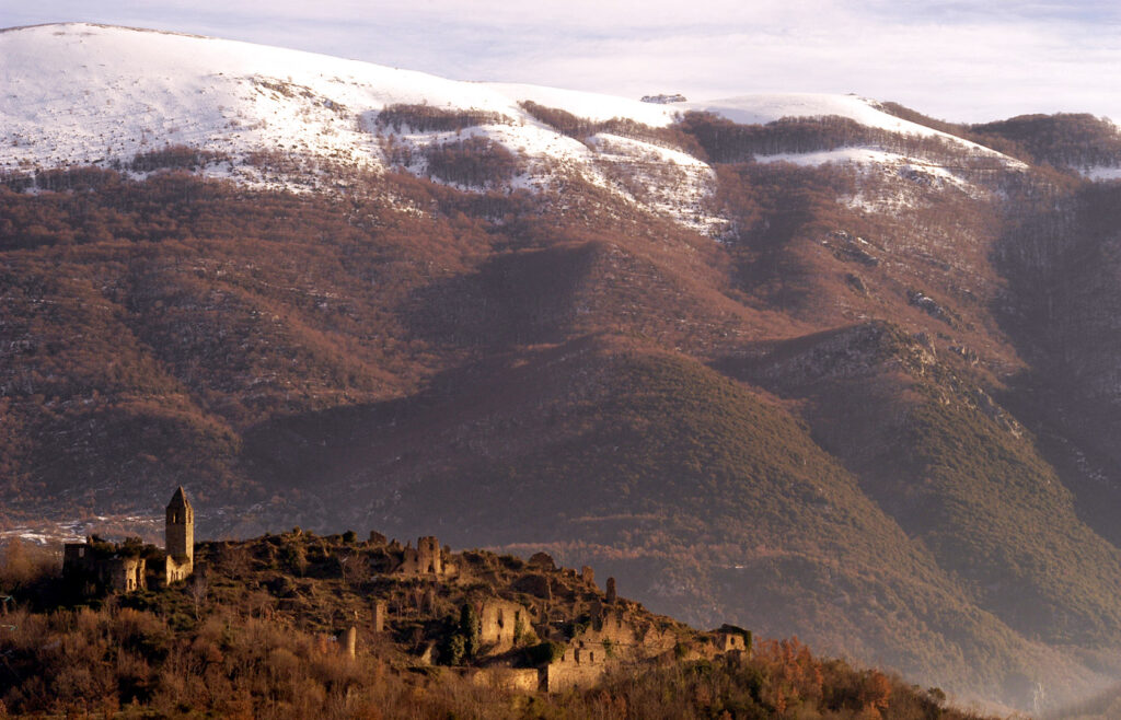
Il sentiero può essere percorso agevolmente tutto l’anno a piedi, a cavallo o in bicicletta. Il suo interesse è legato al terremoto del 13 gennaio 1915 che distrusse l’intero paese di Morino provocando decina di migliaia di vittime tra Avezzano e la Valle Roveto. Questo paese, come altri danneggiati, non è più stato ricostruito. I superstiti si sono trasferiti in un nuovo abitato collocato nel fondovalle.
Da piazzale Lo schioppo (730 slm)
A area faunistica del Capriolo e alla cascata
Dislivello 60 m
Lunghezza 2 km
Ore 1; T
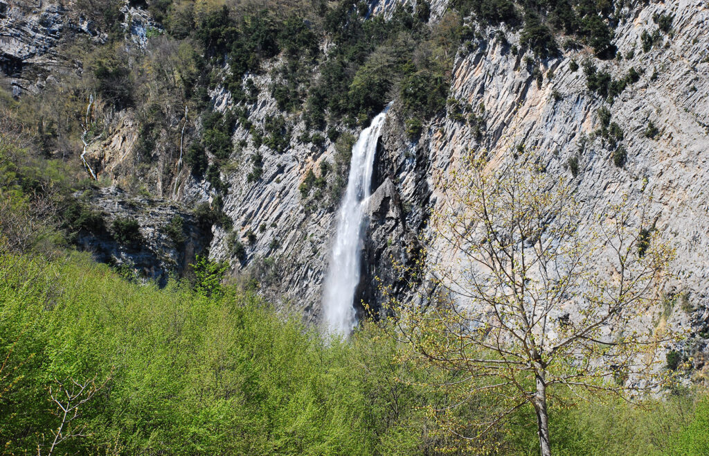
Il tracciato ad anello passa accanto all’area in cui si può osservare il capriolo, tocca il Rifugio dello Schioppo, e raggiunge la parete calcarea verticale da cui, in primavera, sgorga una sorgente carsica: è la sorgente dello Schioppo che origina una spettacolare cascata di oltre 130 metri di altezza. Subito dopo il sentiero ridiscende, tra i boschi di faggio e torna al punto di partenza.
Clicca qui per scaricare la traccia gpx del sentiero
Da xxx
A xxx
Dislivello massimo xxx
Lunghezza xxx
Ore xxx ; XXXX
Il sentiero a piedi nudi nasce dal metodo Kneipp, che sostiene l’importanza e il beneficio del camminare a piedi scalzi nell’acqua, sia per migliorare la circolazione sanguigna che per rafforzare le difese immunitarie. Percorreremo questo breve itinerario a tappe, da effettuare se si vuole a piedi nudi, per dedicartci un momento di cura e relax a contatto diretto con gli elementi naturali. Si può camminare nelle fresche acque del torrente Lo Schioppo, deviato in una delle “formelle” realizzate dai monaci cistercensi, oppure sui materiali naturali come ciottoli, erba, corteccia e legno che trovi sul sentiero e sederti a godere della quiete circostante.
Da Area Sosta di Piano Sacramento (646 m), le Scalelle, Buco del Caùto (1138 m), Eremo del Cauto (1137 m)
ore 3; EE.
Cauto – Santa Maria del Pertuso
Questo sentiero è sicuramente tra i più suggestivi della Riserva, sia per gli scorci paesaggistici sia per l’emergenza architettonica che raggiunge: la chiesa rupestre di Santa Maria del Cauto. Immersa nel silenzio, a mille metri di quota, presenta affreschi della fine del 1100 e testimonia l’importanza di quella cultura monastica che si diffonde in Europa nel medioevo. Il percorso supera un dislivello di circa 300 metri in circa 3 km.
Clicca qui per scaricare la traccia gpx del sentiero
da Buco del Caùto (1173 m) passa per Fonte di Campovano (1508 m), Passo del Diavolo (1948) Iùbero dell’Ortara (1840 m) e arriva a Monte Ortara (1908 m);
ore 2; E.
Da Buco del Caùto (1173 m), Vallone di Femmina Morta, fino al Rifugio di Femmina Morta (1357 m);
Ore 1,15; E.
Da Buco del Caùto (1173 m), Vallone della Salvastrella, arriva al Rifugio della Liscia (1414 m);
Ore 1,0; E.
Da Grancia (475 slm) passa per la centrale ENEL (572 m), La Fossa (1101 m), Resicco, fino al Rifugio della Valle dell’Inferno (1236 m);
Ore 3,5; E.
da Rendinara (916 slm) lungo la carrareccia del Vallone del Rio, Fonte Pretestretta (1020 m), Fonte Pisciarello (1264 m), Rifugio del Vallone del Rio (1340 m), Monte Pratillo (2070 m), fino a Pizzo Deta (2041 m);
ore 3,5; E.
da Rendinara (916 slm) a Fonte Pretestrette (1020 m), la Fontanella (1760 m), la Lota (1856 m), Monte Ginepro (2004 m), Monte Cappello (1981 m), Monte Brecciaro (1885 m), Monte del Passeggio (2046 m), Pizzo Deta (2041 m);
ore 4,5; EE
Clicca qui per scaricare la traccia gpx del sentiero